
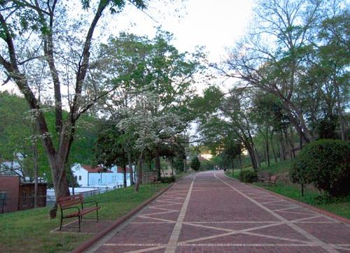
Arkansas Scenic Byways Program was established shortly after Congress passed the Intermodal Surface Transportation Efficiency Act of 1991. This federal legislation created the framework to develop a network of National Scenic Byways.
The Arkansas Highway Commission adopted criteria by which routes in Arkansas could be designated as Arkansas Scenic Byways. The purpose of this program is to facilitate Arkansans’ recognition of special routes within the state.
Scenic Byways:
Camden Expedition Scenic Byway
Designated as a State Scenic Byway in 2021, this route focuses on and promotes heritage and Civil War tourism in the communities that were impacted by the Camden Expedition of 1864, during which Union Major Gen. Frederick Steele attempted to move troops from Little Rock to meet with other Union forces at Shreveport, La., in a plan to invade Texas during the spring of 1864.
The byway affects the following communities and surrounding areas: Little Rock, Benton, Malvern, Rockport, Arkadelphia, Hollywood, Okolona, Prescott, Washington, Camden, Fordyce, Sheridan, Leola, and Prattsville. Arkansas State Parks included in this route include: Historic Washington State Park; Poison Springs Battleground State Park; Mark’s Mill Battleground State Park; and Jenkins Ferry Battleground State Park.
Overall, the Camden Expedition Scenic Byway follows a loop that begins at Little Rock and goes southwest along Interstate 30 to Old Washington State Park in Hempstead County. From there, it returns to Prescott along I-30 before proceeding east along Hwy. 24 to Camden, where it turns north along Hwy. 79 to Fordyce. The scenic byway then turns northwest along Hwy. 8/9 to Tulip before going northeast along Hwy. 46 to Leola and Sheridan. At Sheridan, it follows Hwy. 35 North to Benton before returning to Little Rock.
Crowley’s Ridge Parkway National Scenic Byway
The Crowley’s Ridge Parkway, a 198-mile long route consisting of segments of 17 highways, two county roads, and several city streets, was designated as an Arkansas Scenic Byway in 1997. In 1998, it was designated as Arkansas’ first National Scenic Byway by the U.S. Department of Transportation, Federal Highway Administration.
This byway follows the geologic formation known as Crowley’s Ridge through northeast and east-central Arkansas. Approximately two million years ago, wind blown soils collected in an area between the meandering channels of the Mississippi and Ohio Rivers. This wind blown soil, known as loess, formed a ridge rising up to 200 feet in places above the surrounding flat delta region.
This high ground quickly became a magnet for human settlement. Today it is characterized by upland hardwood forest, farmland, orchards, and a wide variety of recreational and historical resources.
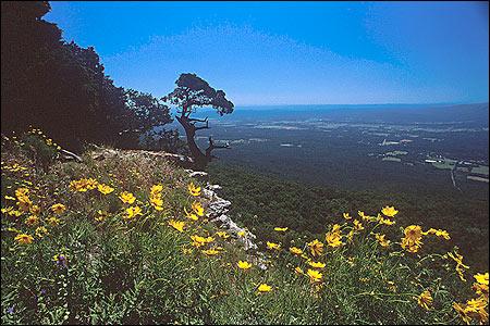
Arkansas Scenic 7 Byway
Highway 7 from Arkadelphia to Harrison became Arkansas’ first scenic byway in 1993. The scenic byway was extended in 1999 to include the highway from the Louisiana state line to Arkadelphia. Scenic Highway 7 is approximately 290 miles in length.
Scenic 7 starts in the coastal plain region of southern Arkansas. This area consists of lowland rolling hills covered with dense pine forests and numerous river valleys covered with bottomland hardwood forests. The region is rich in wildlife, outdoor recreation, and historical resources.
South of Hot Springs travelers will enter the Ouachita Mountains which are noted for wide valleys, rich agricultural lands, timbered mountains and abundant wildlife. The Ouachita Mountains are unique in that they are the only mountain range in the U.S. whose ridges and valleys are oriented west to east.
Next is the Arkansas River valley between the Ouachita and Ozark Mountains. Since the earliest days of European settlement in Arkansas, this valley has been an important transportation corridor and has been served by flatboats, keelboats, and steamboats, and the overland stage coach.
In the northwest portion of Arkansas, Scenic 7 traverses the Ozark Mountains. This region is famous for its colors, particularly in the fall when the oak-hickory forest turns to yellows, oranges, and reds contrasted by bright green pines and the spring when the dogwoods, redbuds, wild plums, and wildflowers bloom. The Ozark Mountains are also noted for their clear mountain streams.
Boston Mountains Scenic Loop
Two separately designated routes make up the Boston Mountains Scenic Loop.
Highway 71 from Dean’s Market to Fayetteville was designated as an Arkansas Scenic Byway in 1998. Scenic Highway 71 begins at the edge of the Arkansas River Valley and extends 42 miles across the Ozark Mountains to Fayetteville. These rugged mountains are home to quaint craft shops, mountaintop lodging, and spectacular vistas.
Interstate 540 from Dean’s Market to Fayetteville was designated as an Arkansas Scenic Byway in 1999. This byway roughly parallels Highway 71 and also begins at the edge of the Arkansas River Valley, winding 38 miles north to Fayetteville. Constructed through very rugged terrain in the Ozark Mountains, this route includes several high-span bridges and the State’s only highway tunnel, the Bobby Hopper Tunnel.
This byway is known for its spectacular views of the oak-hickory forested mountains and small farms nestled in picturesque valleys.
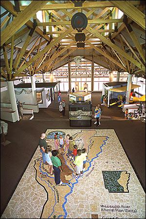
Great River Road National Scenic Byway
The Great River Road was established in 1938 as the national parkway of the Mississippi River. It extends through ten states along the river and offers glimpses into how the heartland of America developed. The 362-mile route in Arkansas consists of segments of 13 highways, several forest service and county roads and city streets. The Great River Road was designated as an Arkansas Scenic Byway in 2001. In 2002, it was designated as Arkansas’ second National Scenic Byway by the U.S. Department of Transportation, Federal Highway Administration.
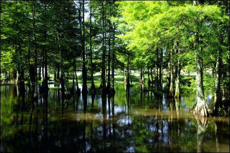
The Great River Road traverses the ten Arkansas Counties that border the Mississippi River. This region, known as the Delta, is part of the nation’s largest alluvial plain. Travelers on the route experience both the mighty river and its legacy of shaping landscapes and lives along its path.
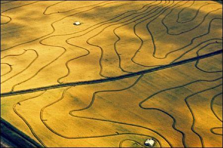
At the time of pioneer settlement, most Delta terrain was lowlands and swamps, rich in virgin timber and wildlife. Some two centuries later, it is largely agricultural, producing voluminous crops of soybeans, rice, cotton and wheat.
For much of its length, the Great River Road traverses agricultural lands, passing remnants of the original wetlands and traveling through towns whose histories and economies were influenced by the river. From Marianna to Helena, however, the route penetrates the woodlands of the St. Francis National Forest on Crowley’s Ridge.
Highway 21/Ozark Highlands Scenic Byway
For 35 miles, Highway 21 from Highway 64 to the Buffalo National River traverses the Boston Mountains region of the Ozark Mountains. The Byway, designated in 2005, offers a serene drive through the Ozark National Forest as well as many recreational opportunities and striking vistas before arriving at the nation’s first National River. Watch for elk near the Buffalo National River, deer, black bear and eagles.
Open Map (.pdf)
Interstate 530
Designated as a State Scenic Byway in 2001, this Scenic Byway extends 15 miles from Highway 256 in White Hall to Highway 65 southeast of Pine Bluff. I-530 traverses part of the 300-mile long Bayou Bartholomew, the world’s longest bayou. These wetlands are populated by bald cypress trees, an assortment of birds and waterfowl and more than a hundred species of fish, as well as otters and alligators.
Open map (.pdf)
Mount Magazine Scenic Byway/Highway 309
This 45-mile portion of Highway 309 was designated as an Arkansas Scenic Byway in 1994. This byway starts at highway 10 in Havana and proceeds north over Mount Magazine, the highest point in Arkansas at 2,753 feet. This mountain was named by French explorers who recognized a resemblance to magazines used by the French military to store ammunition.
North of Mount Magazine, Highway 309 descends into the rich farmland of the Arkansas River Valley where it ends at Highway 23 in Webb City.
Open Map (.pdf)
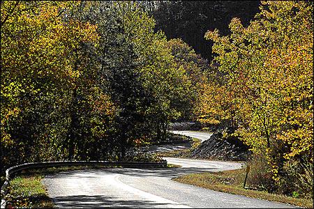
Pig Trail Scenic Byway
The Pig Trail Scenic Byway is a Forest Service Scenic Byway. Beginning in the southeast corner of the Ozark National Forest near I-40, The Byway extends north along Highway 23 for 19 miles to Highway 16 at Brashears. With its many steep inclines and sharp curves, driving the Pig Trail may be likened to riding a roller coaster. Trees crowd the roadside, creating a shady corridor during the summer in some areas and display stunning fall color. Very little development has occurred along this route, offering travelers a glimpse of the Ozarks that would have been familiar to the early settlers.
Open Map (.pdf)
Sylamore Scenic Byway
The Sylamore Scenic Byway is a Forest Service Scenic Byway located in the southeast corner of the Ozark National Forest. The byway begins at Calico Rock and proceeds along Highways 5 and 14 and Forest Service Road 110 to Blanchard Springs Caverns. The white oak-hickory forests provide an early spring view of dogwoods and redbuds and majestic fall color. Hiking trails abound for a closer view of the many hillsides and waterfalls.
Talimena Scenic Drive National Scenic Byway
Highway 88 from Highway 71 in Mena to the Oklahoma State Line was designated as an Arkansas Scenic Byway in 1998. This route climbs to the ridge of Rich Mountain, elevation 2,681 feet, and passes through Queen Wilhelmina State Park on its way to the Oklahoma State Line 18 miles to the west. This route is also part of the Talimena Scenic Drive which extends from Mena west to Talihina, Oklahoma. In 2005, Talimena Scenic Drive was designated the State’s third National Scenic Byway. Noted for colorful fall foliage, the route is considered one of the premier motorcycle routes in the state.
West-Northwest Scenic Byway
Designated as a State Scenic Byway in 2005, the West-Northwest Scenic Byway is comprised of 261 miles of interconnected highways including Highway 71 from Mena to I-540 and portions of Highway 10 from Ola to the Oklahoma State Line and of Highways 23 and 96. Much of the Byway lies within the Ouachita National Forest. Crossing the only mountains in North America that are oriented east-west, the terrain is less rugged than the Ozark Mountains, so was more hospitable to early settlers. Many museums, historical sites and small towns characterized the area today.
Designation Criteria
Upon receipt of a written request to designate a route or a portion of a route as an Arkansas Scenic Byway, the following steps will be taken.
- The route must be designated as a “scenic highway” by the State General Assembly.
- An active organization composed of various private and governmental groups, businesses, and agencies who are interested in preservation, enhancement, marketing, and development of the route’s scenic, cultural, recreational, and historic qualities must be established.
The sponsoring organization must include the County Judge, or an individual appointed by the Judge, or Quorum Court of each county through which the potential byway passes. The organization must also include the Mayor, or an individual appointed by the Mayor or City Council, of each incorporated community through which the potential byway passes. The request must be accompanied by support from any cities and/or counties through which the Scenic Byway is routed, including appropriate City Council Resolutions and/or Quorum Court Orders. - The sponsoring organization must submit a plan to be used by the organization to promote and market the byway after designation. The plan must include specific efforts to be undertaken to promote and market the byway as well as methods of financing the efforts.
- The route’s corridor must contain abundant scenic, cultural, recreational, and/or historic qualities that would be of interest to tourists. Segmentation of the route will be considered if development patterns exist which may detract from the overall character of the byway.
- The route must be submitted to the Arkansas Department of Transportation (ARDOT) who will conduct a study to determine its qualifications as a candidate for scenic byway designation. The study should include local jurisdiction’s position on byway designation and segmentation. The study will be conducted in cooperation with the Department of Parks and Tourism.
- If the study demonstrates the route qualifies, the ARDOT will submit it to the Arkansas Scenic Resources Preservation Coordinating Committee (ASRPCC) for their consideration.
- A public meeting will be held to solicit public input regarding byway designation and to answer any questions that may arise.
- After ASRPCC consideration and after the public meeting the Highway Commission may adopt the route and designate it as an official scenic byway with appropriate identification on State Highway Maps and distinctive scenic byways logos and signing.
Contact Information
For more information about the Arkansas Scenic Byways Program you can contact the ARDOT at (501) 569-2088 or by e-mail to: scenicbyways@ardot.gov